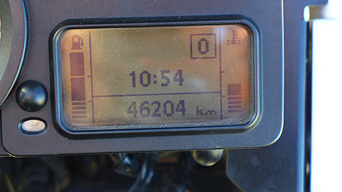
It’s Tuesday night after my first TT2000. I’ve just ridden my motorcycle 2,406 kilometres over a 48 hour period. The riding went from checkpoint to checkpoint amassing scores of between 1,000 and 5,000 points depending on the severity of the checkpoint. I ended up with 68,000.
The ride was ‘invented’ by Mike Hyde who wrote books about motorcycling in the USA, Australia, and around New Zealand. Sadly in 2015 Mike passed away but there are enough enthusiasts to keep the ride running.

This year there were two starts – one in Picton and one in Dunedin. Both ended in Christchurch. The checkpoints were released several months before the event so riders could plan their route to meet the distance requirements, and to get the minimum number of 50,000 points.

I’d recently bought a Garmin Zumo 590 and so spent time using the Garmin Basecamp app to work out where I was heading. The logical place for me to begin, as a Wellingtonian, was Picton. The ride began midday on Friday 19 February. The deal was to make it to Christchurch before midday on Sunday 21 February.
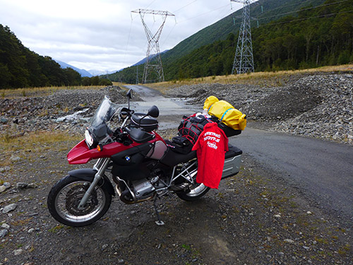
I’d planned a route that headed first to Hakahaka Bay east of Picton, then back to Picton, down the Wairau Valley to Nelson Lakes National Park, across to Tapawera, up the Moutere Valley, over the Takaka Hill all the way to Whanganui Inlet (8km from the start of Farewell Spit) then back over Takaka Hill taking in Mairahau and Kaiteretere. I’d worked out that I’d arrive sometime around 10.30pm in Murchison where I had booked a cheap cabin for the night.


The first day was around 650km. I managed 25,000 points, already at the half way mark on points at least.
| Hakahaka Bay | 5,000 |
| Wairau Valley | 2,000 |
| Rainbow Skifield | 5,000 |
| West Bay | 1,000 |
| Tapawera | 2,000 |
| Whanganui Inlet | 5,000 |
| Courthouse Cafe, Collingwood | 1,000 |
| Pupu Springs | 1,000 |
| Mairahau | 2,000 |
| Kaiteriteri Beach | 1,000 |
| SUB TOTAL | 25,000 |
| Murchison campground for the night | $25 |
The first day riding was great weather. No wind and the temperatures relatively mild.
Despite requests from the organisers for riders to take care on the road to Hakahaka Bay there were some speedsters who decided the road was too much fun to move sedately. Three riders tailgated me on the way back to Picton so I indicated to let them past. Two made it successfully, the third went a little too fast for the immediate corner. He got caught in the loose gravel on the shoulder and, despite me thinking for a moment he was going to recover, the lip back up onto the road proved too big an obstacle and he went down into a ditch. His right leg went under the bike. By the time I had found flat ground to park my motorbike two other riders had pulled this chap out of the ditch and were checking him, and his bike, for injuries. He said he was OK but the way he kept rubbing his leg indicated to me that he was running on adrenalin and that he’d be in a lot more pain and discomfort further down the line.
I found out at the end of the ride that one other rider had come off on that stretch of road.
The Takaka Hill is always a highlight for motorcyclists and it didn’t disappoint.
Travelling back through Motueka I couldn’t bring myself to have McDonalds, or Fish & Chips. So I carried on riding. By the time I got back through Tapawera I was starving. I’d packed a small gas primus so sat on a park bench outside the closed Tapawera cafe and cooked up a freeze-dried meal of Lamb Curry. Just what the doctor ordered.
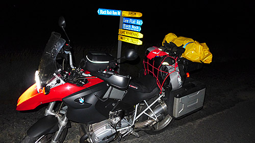
My bike, a BMW R1200GS, only has a cruising range of around 330km. And it seemed that there was limited 24 hour petrol in the top and west of the South Island. Murchison seemed to be the logical place to stay if I wanted a decent rest before what I knew to be a huge ride the next day based on how far I could get on a tank of gas. I arrived at the Murchison camp ground where I had pre-booked a cabin around 10.30pm. Got chatting to two other TT2000 riders who had decided to stay in the same campground. We traded war stories and hit the sack not long after.
I made an early start on Saturday morning leaving at around 6.30am. The first checkpoint was Six Mile Walkway about 9 kms from Murchison. There was fog around at that time of the morning – it was a really nice little valley albeit a bit chilly at that time. An old white mare looked over the fence as I took my checkpoint photo.

I headed back to Murchison and on to Inangahua. Following that it was to Westport.
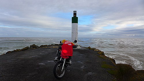
Carters Beach at the mouth of the Buller River was a very impressive checkpoint, and not one I would have enjoyed being at in bad weather.
After that I headed to the Fox River Bridge, then Greymouth for breakfast, then down to Kaniere. I realised that I had stuffed up my planning a little and missed Roa which I should have done before hitting Greymouth. I decided at only 2000 points I could leave it out altogether.
The route then took me over the Arthurs Pass where I hit rain. I decided not to put the rain suit on, rightfully expecting that the 30 degree temps in Canterbury would dry me out in short order.
(A) – I didn’t get that damp, and
(B) – I was right about the hot temperatures.
| Six Mile | 2,000 |
| Inangahua | 2,000 |
| Carters Beach | 2,000 |
| Fox River | 2,000 |
| Kaniere | 2,000 |
| Inchbonnie | 1,000 |
| Klondyke Corner | 1,000 |
| Cave Stream | 1,000 |
| Coopers Creek | 2,000 |
| Pudding Hill | 2,000 |
| SUB TOTAL | 17,000 |
| TOTAL POINTS | 42,000 |
Coopers Creek was interesting. My GPS sent me down a gravel road. Not a gravel road with tyre tracks and hard packed shingle – a gravel road with three inches of metal. I slid all over the place. The GPS then took me to an intersection with more gravel and a ford! FFS! A road sign said the ford was closed. It didn’t look that bad to me so I crossed it. After taking my photo I recalibrated the GPS to avoid unsealed roads. The last thing I wanted was to tip off in a remote country lane and not be able to pick up my bike.
Pudding Hill is the beginning of the road up to Mount Hutt. I saw a few bikes travelling to the checkpoint as I was heading back out to the main highway. I didn’t know if they had started in Picton, or were bikers from the Dunedin start heading north. It felt about halfway between the two starts so either was possible.
I gassed up in Geraldine, and had a restorative lime milkshake in Fairlie. It was bloody hot. Even the man in the fish and chip shop said so.
Next through the Mackenzie Country – some of my favourite roads in New Zealand. I witnessed a few stupid tourists in small underpowered sedans pull out and overtake truck and trailer units with not much room to spare, and then if that wasn’t enough they promptly overtook a car on a blind bend. I was yelling expletives inside my helmet! It seemed to work and everyone survived, just.
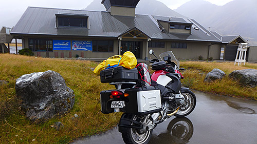
Mt Cook airfield is a stones throw from the Hermitage. There was a massive black rain cloud hanging over the Hermitage basin. This impending deluge demanded a rain suit so I pulled over to pull it on. The wind was blowing hard, directly at me. I was being buffeted and blown all over the road. It wasn’t pleasant. Then the downpour hit. I took my photo as quick as I could (another 5,000 pointer so worth the effort) and got on my way. The ride back was stupendous with the wind directly at my back. Absolutely no wind noise in my helmet as my road speed seemed to match the wind speed. I did the normally 40 minute ride in what seemed about 25 minutes.
Fueled up in Omarama. Next stop was Aviemore. The road to the lake took me across the Benmore Dam. It was around 6.30pm and the sun was getting lower in the sky. Such an amazing experience riding across this massive man-made structure surrounded by incredible countryside. Last time I rode across there I was on a Yamaha TT500 in the early 80’s when I was at university in Christchurch. I have to get back to that place and spend a bit more time there.
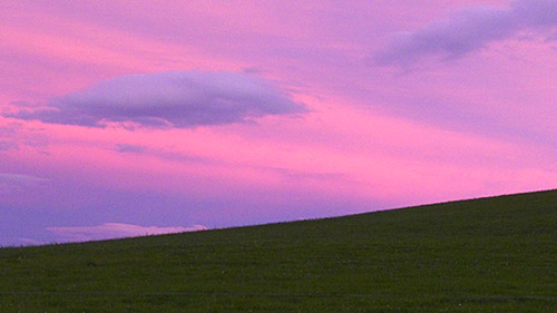
Elephant Rock is on the south side of the Waitaki Valley. You head some of the way to Danseys Pass but before you hit shingle veer off to the east. The landscape is rolling pastureland with outcrops of limestone. I spent a bit of time at the Elephant Rock checkpoint eating a muesli bar and watched the reddening sky as the sun set.
Elephant Rock was a point at which I had to make a big decision. If I just wanted to meet the minimum guidelines I could head towards Christchurch and pick up Clandeboye and Pleasant Point to meet the 50,000 point minimum. The ride back to Christchurch at that point would have given me the required 2,000 km.
If I was feeling good the alternative was to carry on south to pick up three checkpoints south of Dunedin. One of them at Lees Flat was worth 5,000 so it was a serious consideration.
I’m not one to do things to the minimum. The Iron Butt Rally(11,000 miles in 11 days) in the USA is on my bucket list so I was keen to see how far I could ride. I felt OK. Remarkably so. What would be the consequences if I felt tired? I’d stop and pitch a tent, have a rest and carry on.
I decided to head south.
I reached Dunedin around 10.30pm. I got caught up in a breath testing traffic stop on George Street, surrounded by partying new university students. The nice cop, an elderly man, laughed with his breathalyser and said “This is going to be interesting!” as there was no way I could speak into the thing with my helmet on. When I told him I’d driven down from Murchison he decided to let me go without the official measurement. After all, it didn’t look like I had been out on the turps.
Gassed up and had a coffee in Mosgiel. Then began the ride inland to Lees Flat. It was closer than I thought. The challenge for the next three checkpoints was getting the bike and the location correctly exposed in the photos so that the scrutineers could determine if I had actually been to where I said I had. Lees Flat was OK – the checkpoint was photographing the bike in front of a highly reflective road sign.
If I thought that was the biggest of my problems I was wrong. The GPS decided it wanted to send me on shingle roads again. Because a GPS only looks as far ahead as the next intersection or turn I thought that surely 4.1 km of gravel would lead me to a sealed road. Remember, it’s pitch dark. I’m in the country. From what I could see there were no farm houses, and there certainly wasn’t any other traffic. While I have HID headlights it was difficult to read the condition of the road. It appeared to be hard packed but very corrugated.
After 4.1 kms of riding I get to the next intersection. Still more gravel, this time I think for about 6kms. I carried on, again hoping that this was leading to a nice sealed road. Wrong. The next stretch, again unsealed, was 19.1 km. And the conditions were getting worse. It was too late to turn back so I kept going. Steep downward declines and upward inclines. Extensive corrugations. Not a soul to be seen anywhere. I was completely discombobulated. The GPS showed I was heading north which I thought was non-sensical. At one point I thought I was on the coast as I crossed a bridge near a heap of what looked like fishing boats. It turned out when I looked at the map the next day that I had crossed Lake Mahinerangi. Who would have thought.
I finally arrived in Lawrence where I struggled to photograph my bike in front of the stone house which was set quite a way back off the road. I was shining a torch at the house, using my camera flash, and keeping the bike running so I could make use of the headlights. It’s after midnight and I figured any moment someone is going to come out with a shotgun and drive me off.
I left Lawrence on a sealed road – next stop the Clutha Ferry. But, 3 km down the road the GPS tried to send me on more gravel. Enough was enough. It might have been quicker as the crow flies but certainly not quicker in terms of peace of mind. I re-routed and headed off. But I was still confused as to what direction I was heading. I honestly thought I was heading UP the Clutha River with the ferry crossing on the east side, when in fact it was completely the opposite.
I found Clutha Ferry and rode half way down the small track to get closer to the sign so the photography would be easier. Halfway down I realised the track was narrow, and I couldn’t easily turn around back up the hill. There was a big ROAD CLOSED sign at the bottom of the track with a larger turning circle beyond the barricade. Only thing to do was ride beyond the barricade, do the photo and then ride back out. I have a slight nervousness making tight turns on narrow shingle tracks. This stems from a solo ride I did seven years back when I dropped my bike on a steep section of the Dunstan Range. For the life of me I couldn’t pick the bike up. And I didn’t want to be in the same predicament in the middle of the night this time.
All was fine. I turned the bike around and rode out of there, back through Dunedin heading north to Christchurch.
On the way down SH1 four hours previously I had spotted a camping spot (actually, just a blue sign with a tent on it) in Herbert, about an hour north of Dunedin. Doing the return trip I arrived in Herbert at 3.30am – at this stage I’d been riding 21 hours. I was buggered. I needed to rest.
I rode as quietly as I could into the Glencoe DOC campground and cut the engine. With a head torch strapped to my noggin I erected my small tent, blew up a 3/4 air mattress and fell into a deep sleep. Woke up freezing at 5.50pm. I can tell you two hours sleep was a pretty good effort. As quietly as I could I packed everything up and left the campground at 6.30am. No-one saw me arrive and no one saw me leave. I’m sure they heard me though.
I slogged it back up the line, having breakfast in Timaru (finally succumbing to a bacon and egg McMuffin, yes at McDonalds) before picking up Mystery Bonus #4 at the Pleasant Point railway museum. Further down the road there was the official noted railway station checkpoint in Pleasant Point, and finally the flag poles at the Clandeboye milk plant. Then on to the finish at Hamptons in Christchurch.

| Mt Cook Airport | 5,000 |
| Aviemore | 2,000 |
| Elephant Rock | 2,000 |
| Lee Flat | 5,000 |
| Lawrence | 2,000 |
| Clutha Ferry | 2,000 |
| Mystery #4 | 4,000 |
| Pleasant Point | 2,000 |
| Clandeboye | 2,000 |
| Hamptons, Christchurch | 0 |
| SUB-TOTAL | 26,000 |
| GRAND TOTAL | 68,000 |
I arrived at Hamptons at 10.50am. There were quite a few riders there already. I handed over my camera card, and my score sheet, had a sausage, spoke to a few riders I had met along the way, and then left to stay with friends.
I want to thank the organisers. It was heaps of fun. I feel like I exceeded my own expectations. And while I can’t remember every part of the ride I know that I experienced some amazing weather, some amazing countryside, and a real sense of accomplishment.

I’ll definitely be back next year.

Thanks very much for this great write up of your TT adventure.
We’ll see you next year.
Cheers
Nicky.
You sure will!
Great story Al. Iron Butt Rally – now that worries me!
Don’t be worried Garth – I probably won’t get picked. It’s very hard to be chosen, let alone complete.